
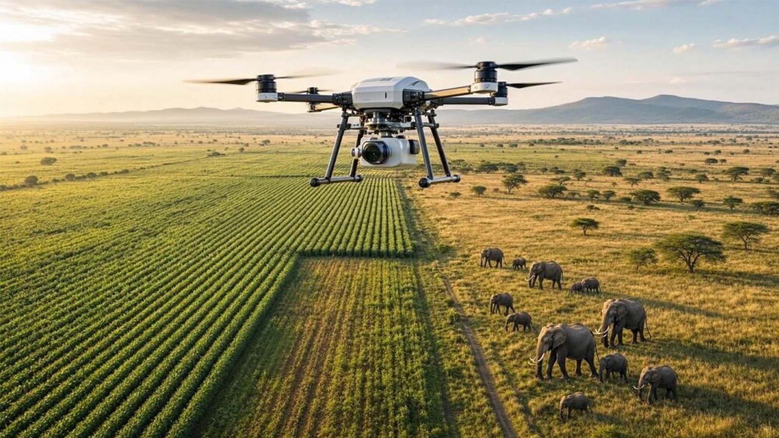
Agriculture and conservation now face a similar operational problem: both depend on timely observation, yet manual monitoring is slow, fragmented, and difficult to scale across large fields, wetlands, and sensitive habitats. Growers need earlier insight into weeds, stand gaps, pest pressure, and nutrient stress, while conservation teams need faster ways to detect invasive species, monitor wildlife populations, and document ecological change with fewer blind spots. This is the context in which Sairone’s computer vision platform becomes relevant, because it is designed to turn drone, orthomosaic, satellite, video, and multispectral imagery into actionable outputs for agriculture and environmental monitoring. For professional readers, the value is practical: the platform’s relevance lies not in abstract AI claims, but in how image-based analysis can shorten response time, improve targeting, and support more defensible decisions in the field.
Why image intelligence matters
Modern crop production is under pressure to protect yield while reducing waste, herbicide overuse, and unnecessary passes across the field. Sairone positions its system around that need by offering AI-based analysis for soybean production that focuses on early detection of weeds, pests, diseases, nutrient deficiency, stand count, crop monitoring, and crop yield estimation from drone or satellite imagery. That matters because the business value of computer vision in agriculture is strongest when it helps managers act earlier and more precisely rather than simply producing more maps.
The same logic applies to conservation. Sairone’s public materials describe the platform as a tool for environmental monitoring that can detect invasive species and monitor wildlife populations, while broader conservation AI literature shows that machine learning and computer vision are increasingly used for biodiversity monitoring, habitat assessment, and time-critical detection tasks. In other words, the platform sits at the intersection of two urgent needs: better agricultural visibility and better ecological surveillance.
This dual relevance is consistent with wider research trends. A 2026 review on biological image analysis states that automated counting is essential for scaling wildlife monitoring and biodiversity assessment because manual processing limits analytical effort and scalability, while a 2024 review on AI for wildlife conservation describes computer vision as a scalable way to detect and classify animals, humans, and poaching-related objects across different environments. When that same image-analysis logic is applied to fields, weeds, seedlings, and crop stress, the result is a common monitoring framework that supports both production efficiency and environmental stewardship.
How Sairone supports crop monitoring
Sairone’s agricultural value proposition is built around translating imagery into specific agronomic tasks rather than generic analytics. Its published soybean solution highlights weed control, plant health monitoring, pest detection, crop disease detection, stand count, crop monitoring, and yield estimation as core use cases for growers, agri-corporations, and agro-service providers. The same page says the platform is designed to help users save time and labor, avoid overuse of fertilizers, herbicides, and pesticides, detect stress early, and generate map-based recommendations for spraying and fertilizing.
That combination matters because crop monitoring often fails when detection is disconnected from action. Sairone states that its soybean stand-counting workflow can evaluate planting density, compare growth stages, and export geotagged outputs in formats such as CSV, Shapefile, and GeoJSON, which suggests a direct link between image analysis and operational planning. For farm teams, that means computer vision can support replanting decisions, stand uniformity checks, and more structured documentation instead of relying only on selective manual counts.
Its weed-management positioning is equally practical. Sairone says it can identify and map invasive weed pressure in soybean fields, cluster weed detections, support early-season hotspot detection, and export weed-pressure maps for scouting or treatment planning. In the Ontario fleabane project, the company describes a no-code workflow that allows users to upload drone or orthomosaic imagery, automatically stitch and prepare images, detect herbicide-tolerant weeds, geotag infestations, export maps or CSV files, and generate herbicide application maps or targeted intervention scripts.
These claims align with the broader scientific literature on computer vision in crop protection. Recent reviews of automated biological image analysis and field monitoring show that deep learning and computer vision are now used across UAVs, remote sensing, and ecological imagery for detection, counting, and classification tasks, although performance still depends on data quality, occlusion, model generalization, and labeled datasets. That context matters because it places Sairone’s product positioning within a larger, evidence-based trend rather than treating it as an isolated vendor claim.
A practical summary of Sairone’s crop-monitoring functions looks like this:
| Function | What Sairone says it does | Why it matters operationally |
| Stand counting | Counts soybean stands, evaluates planting density, supports row and drilled soybeans, and exports geotagged outputs. | Helps identify stand gaps, uneven emergence, and plant-density issues earlier. |
| Weed detection | Detects species-specific weeds, maps hotspots, and supports exportable weed-pressure maps. | Improves scouting efficiency and supports targeted control rather than broad reaction. |
| Pest and disease monitoring | Lists pest detection and crop-disease detection within plant-health monitoring. | Supports earlier intervention when visual stress needs to be identified quickly. |
| Nutrient and stress analysis | Public video materials describe nitrogen-content estimation and crop-issue detection. | Helps move fertilization and crop protection toward evidence-based timing. |
| Yield-related analysis | Offers crop detection and yield estimation for soybean monitoring. | Improves logistics planning and in-season visibility into crop performance. |
A closer look at the Ontario fleabane case
The strongest public example of Sairone in field use is its Canada fleabane detection project in Ontario soybean farms. According to the published case page, the project was funded by the Ontario Agri-Food Research Initiative under the Sustainable Canadian Agricultural Partnership and focused on detecting herbicide-tolerant Canada fleabane in soybean fields using AI and drone imagery. The company presents the problem clearly: herbicide-tolerant weeds increase input costs and yield loss, while many farmers are left with large stores of raw drone and equipment imagery but no practical way to use it.
Sairone’s response was not simply to build a detection model, but to frame the platform around adoption barriers. The case page says the workflow was designed as a no-code platform so farmers could process their own imagery without depending on expensive subscriptions or sharing data with chemical suppliers, and it explicitly emphasizes privacy-respecting collaboration, model ownership, and data ownership. That is important because adoption in agriculture is often limited not only by technical accuracy, but by cost, usability, trust, and uncertainty about who controls the information generated on the farm.
The project also shows how computer vision can support targeted intervention. By combining drone imagery, preprocessing, annotation, orthomosaic handling, model development, and software integration, the platform was built to identify weed locations and generate intervention-ready outputs such as herbicide maps and treatment scripts. In operational terms, that means the system is aimed at converting raw aerial imagery into a management layer that agronomists and growers can use, rather than leaving the analysis trapped in separate image files.
From an EEAT perspective, this is one of the stronger aspects of the Sairone positioning. The company does not present computer vision only as a futuristic dashboard; it shows a defined crop, a documented weed problem, a named funding context, a phased development process, and a target user group that includes growers, agronomists, UAV providers, weed researchers, and input-related stakeholders. That kind of specificity improves trust because readers can see where the platform fits in a real agricultural workflow.
From agriculture to wildlife conservation
Sairone’s conservation angle is built around the same core capability: extracting useful meaning from aerial and environmental imagery. Its video materials describe the platform as a tool that can detect invasive species, monitor wildlife populations, and support environmental conservation and wildlife management with actionable insights. Its wildlife-focused content also presents machine learning for wildlife conservation as relevant to ecosystem protection, habitat monitoring, and species preservation.
This is credible because the conservation field already relies heavily on the same technical foundation. The 2026 review on biological image monitoring notes that automated counting is essential for scaling wildlife monitoring and biodiversity assessment, and it evaluates deep learning across camera traps, UAVs, and remote-sensing workflows. The 2024 conservation AI review similarly explains that computer vision systems can support real-time detection for urgent threats and non-real-time analysis for long-term wildlife monitoring and habitat-health assessment.
That matters because conservation work increasingly depends on throughput. Manual review of biological imagery is slow, expensive, and difficult to expand, especially when projects involve large areas, repeated flights, seasonal comparisons, or many species and habitat types. A platform like Sairone becomes relevant in this context when it reduces the effort required to localize invasive plants, identify wildlife presence, and transform environmental imagery into consistent records that can support field response.
There is also an important link between crop monitoring and conservation monitoring. Invasive species detection, spatial localization, counting, and trend comparison are not purely agricultural or purely ecological tasks; they are shared monitoring problems that require robust image processing and accurate classification across variable outdoor conditions. This is one reason Sairone’s positioning across both farming and conservation is logical rather than artificial.
A useful way to understand the overlap is this:
- In agriculture, computer vision helps detect what threatens crop performance, such as weeds, stand gaps, pests, or nutrient issues.
- In conservation, the same vision pipeline helps detect what threatens ecosystem health, such as invasive species, habitat change, or weak visibility into wildlife presence.
- In both cases, the value comes from earlier, more localized, and more scalable observation.
What makes this approach commercially relevant
For a professional audience, the most important question is whether the platform changes workflow in a meaningful way. Sairone’s public materials repeatedly emphasize no-code use, exportable geotagged outputs, cloud processing, API integration, white-labeled deployment, and support for drone, orthophoto, satellite, and video analysis. Those features matter because they suggest the platform is designed not only for technical experimentation, but also for integration into agronomic service models, agtech partnerships, and applied environmental programs.
The company also frames its offer around measurable operational pain points. In soybean production, it links computer vision to reduced overuse of fertilizers, herbicides, and pesticides, earlier detection of weeds and pests, logistics planning, and more precise prescription mapping. In conservation-related communications, it connects the same technology to invasive-species detection, wildlife monitoring, and sustainability goals.
That commercial relevance becomes stronger when viewed against the scientific literature. Reviews on wildlife monitoring and outdoor vision systems consistently show that deep learning and computer vision are advancing detection, counting, and classification across UAVs and other field-imaging platforms, but they also note persistent challenges such as occlusion, scarce labeled data, and model generalization. A platform that simplifies workflows and narrows the gap between imagery and action therefore has real market value, provided its outputs remain transparent, validated, and usable in the conditions where clients actually work.
Sairone’s computer vision is best understood as a practical monitoring platform rather than a broad AI slogan. Its published agricultural work shows a clear emphasis on weed detection, stand counting, crop monitoring, nutrient-related analysis, and privacy-conscious image ownership, while its conservation messaging extends the same visual intelligence model toward invasive-species detection and wildlife observation. That combination is significant because agriculture and conservation increasingly need the same thing: fast, scalable, image-based insight that can support better decisions before biological or environmental problems become more expensive to manage.